Panama has a tropical maritime climate with a hot, humid, rainy season (May through to December) and a short dry season (January through to May). Geographically Panama is a narrow country from north to south. This results in competing weather patterns coming onshore from both the Caribbean ocean and the Pacific.
Panama is completely outside the hurricane belt and experiences few if any natural disasters except for earthquakes. Panama has several earthquakes each year but less than a handful are felt.
Even with two distinct seasons, temperatures in Panama rarely change more than 20 degrees no matter what elevation you are at.
Summer lasts roughly from December to April. In May, the rains start gradually with frequent showers (most lasting no more than an hour or two) in the afternoons. By July or August, you can count on daily downpours resulting from thunderstorms, especially along the mountain ranges. Often these thunderstorms will result in flash flooding along rivers and roads. So, pay attention to thunderstorms that are building up.
You will find many microclimates throughout Panama especially in the mountainous areas. As trade winds blow weather across Panama the effects are dramatically different depending on the geography surrounding you. Recorded rainfall amounts can be drastically different within areas only blocks from each other.
The whole of Panama lies well below the hurricane belt, and no hurricane has ever hit this part of the Caribbean, making for stress-free, year-round cruising. The weather in Panama is divided into two seasons, dry and wet.
Weather Forecast
Check www. Sailorsnet.com for links to some great weather sites. www.buoyweather.com has detailed weather information based on NOAA´s GRIB files but is partly commercial. Finally, SSB radio nets provide timely local weather information.
Winds in Las Perlas- Panamá
The Pacific Ocean livs up its name and the seas on this side are usually much quieter then on the Caribbean coast of Panama. Close to the mainland winds are usuall from the north during the whole year, with the strongest being from December through February. During these dry, windy months the winds often reach over twenty knots. The winds continue with less strength until Octuber, and pick up again during November.
July and August bring the heaviest rain, although winds are generally weak and variable. There are many squalls that occur during the rainy season, most bring only torrential rain, but some systems, about 2 miles in diameter, can bring up to 45 knotsof wind and loss visibility. There is no way to tell beforehand whether these squalls are accompanied by strong winds, but they are always of short duration.
Winds, Currents and Tides in Bocas del Toro
The weather in Bocas del Toro area, as in most of Panama. Is divided into two seasons, the dry season, from December to April, and the wet season, May to November. The brisk trade winds of the Carribean dry season rarely reach so far below the hurricane belt.
Currents inside Laguna de Chiriqui and Bahia Almirante are generally insignificant, heacy rains and the outflow of the countless rivers that drain into these bays cause the only noticiable currents. The currents at the mouths of these bays, especially near capes and headlands around Canal del Tigre, Boca del Toro and Boca del Drago, can be stronger and are quite unpredictable.
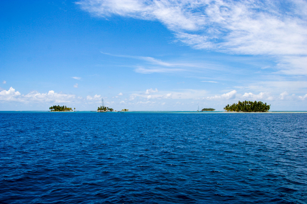
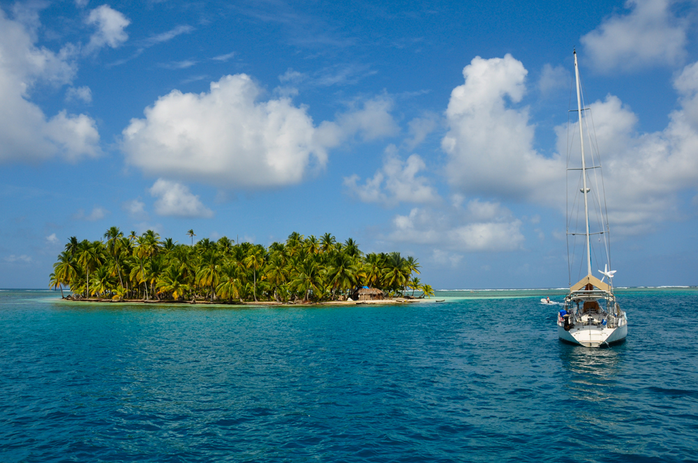
Winds and Weather in San Blas
The San Blas region lies well south of all hurricane tracks. From December through April the northeasterly trade winds prevail, although they are a little less pronounced tha in some other parts of the Caribbean.
The driest months are usually January, February and March, when the weather is sometimes hazy. Cold fronts descending from North and Central America during these dry months usually do not reach San Blas or Costa Arriba. When they do penetrate that far south, they can increase the trades to over 25 knots.
From December to April there are often heavy swells, coming from the rough Colombian coast. The heavy seas break on the outer reefs and once inside San Blas the seas are quite flat.
June brings the rainy season which usually lasts through November. These months are marked by variable winds, flat seas and torrential rains. The rain can fill your dinghy to the brim in a single night.
Tides and Currents in San Blas
The tidal range in San Blas is around 30 centimeters or about one foot and has little effect on navigation except maybe if you are stuck on a sandbar. The current that prevails offshore usuallyflows in an easterly direction but it can also be reversed. Once inside the islands there are no significant currents, only if you anchor right behind a reef that has swells breaking on it will you notice current coming from the reef.